9.1 - UK Physical Landscapes
Distribution of upland and lowland areas in the UK
The United Kingdom is characterised by a diverse physical landscape, broadly divided into upland and lowland regions. These areas are distributed unevenly across the country, influencing settlement patterns and land use.
Location of upland and lowland regions
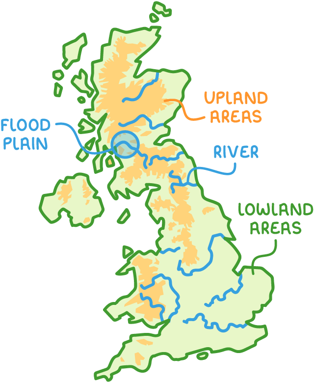
- Upland areas - Predominantly found in the north and west of the UK. These areas are often mountainous, steep, and sparsely populated due to challenging terrain.
- Lowland areas - Located mainly in the south and east. These regions feature gentler, flatter landscapes.
- Settlement patterns - Most major cities and towns are situated in lowland areas, often along the UK's primary rivers.
- Flood plains - These are flat, low-lying areas adjacent to rivers, prone to flooding, yet historically attractive for urban settlements.
Rock types and erosion patterns in different regions
The geological composition of the UK varies significantly between upland and lowland areas, affecting how landscapes are shaped by erosion over time.
Geological differences across the UK
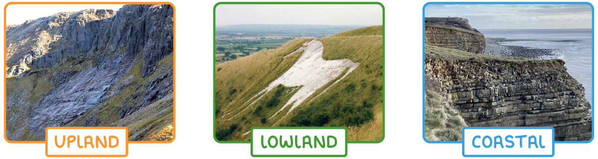
- Upland rock types - Composed of hard, resistant rocks such as igneous (e.g., granite) and metamorphic (e.g., slate and schist). These rocks withstand erosion, maintaining steep and rugged landscapes.
- Lowland rock types - Made up of softer, sedimentary rocks like chalk and clay, which erode more readily.
- Coastal variations - Coastal areas often feature alternating bands of hard and soft rock, leading to uneven erosion patterns. Softer materials, such as boulder clay, erode quickly, while harder formations resist weathering.
Key landforms shaped by glacial activity
Glacial processes from past ice ages have left a lasting imprint on the UK's landscape, particularly in upland areas.
Glacial features in upland regions
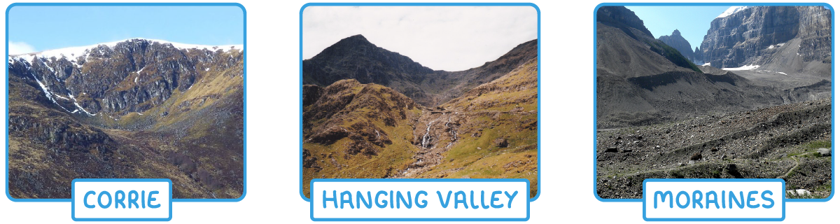
- Evidence of ice age activity - Upland areas show clear signs of past glaciation, such as U-shaped valleys formed by the movement of ice.
- Specific glacial landforms:
- Corries - Steep, bowl-shaped hollows carved into mountainsides where glaciers originated.
- Hanging valleys - Smaller valleys that join a main valley at a higher level.
- Moraines - Ridges of debris deposited by retreating glaciers.
- Protected areas - Many glaciated upland regions are designated as national parks due to their unique geographical features.
Coastal features and processes in the UK
The UK's extensive coastline is shaped by ongoing processes of erosion and deposition, resulting in a range of distinctive landforms influenced by rock type and wave action.
Processes shaping coastal landscapes
- Coastal erosion - Weathering and wave action break down coastal rocks, with softer materials like boulder clay eroding faster than harder rock types.
- Depositional features - Sediments moved by waves and currents create landforms such as spits, which are elongated sandy projections extending from the coastline into the sea.
Notable coastal landforms
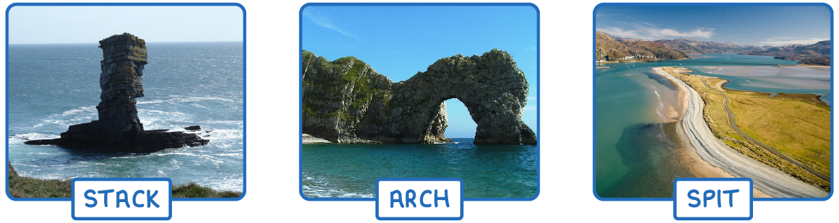
- Stacks - Isolated columns of rock standing in the sea.
- Arches - Natural curved openings in coastal cliffs.
- Spits - Narrow ridges of sand or shingle extending into the sea.
Human interaction with physical landscapes
Human activities have significantly altered the UK's natural landscapes over time.
Modifications to the natural environment
- Land drainage - Historically, marshy, flat, low-lying areas, such as wetlands, have been drained to convert them into productive agricultural land.
- Urban development on flood plains - Many settlements have developed on river flood plains due to their flat terrain, despite the risk of flooding.
- Conservation efforts - Upland areas with unique glacial and geographical features are often protected as national parks.
How were these notes?