12.3 - How to Identify Glacial Landforms on a Map
Understanding contour lines on maps
Contour lines are essential tools on maps used to represent the height and shape of the land. These orange lines provide critical information about the terrain, helping to identify various glacial landforms in mountainous regions.
Key features of contour lines
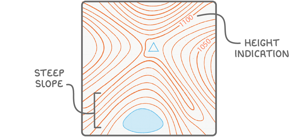
- Height indication - Small numbers on the lines show the elevation of the land above sea level.
- Slope steepness - The closeness of contour lines indicates the gradient of the slope; lines that are very close together signify a steep incline, while lines further apart suggest a gentler slope.
Identifying pyramidal peaks
Pyramidal peaks are striking mountain features formed by glacial erosion, often standing out as prominent high points in a landscape.
Characteristics of pyramidal peaks
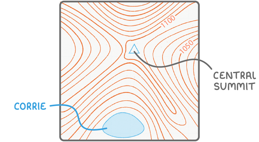
- Contour pattern - Display tightly bunched contour lines that curve outwards from a central summit.
- Associated landforms - Often found with arêtes and corries nearby.
Recognising arêtes and their characteristics
Arêtes are narrow, knife-edge ridges formed by the erosion of glaciers on either side.
Distinctive traits of arêtes
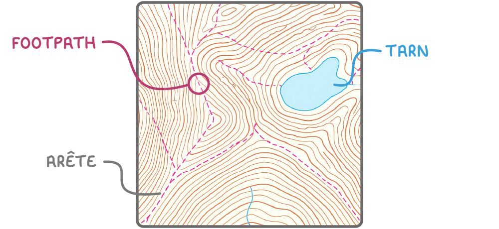
- Contour arrangement - Show closely spaced, parallel contour lines on both sides.
- Surrounding features - Frequently flanked by corries or tarns on either side.
- Naming clues - Often marked on maps with names including terms like "Ridge."
- Common usage - Many have footpaths running along them.
Spotting corries and their typical shapes
Corries, also known as cirques, are hollowed-out, bowl-shaped depressions carved by glaciers.
Identifying features of corries
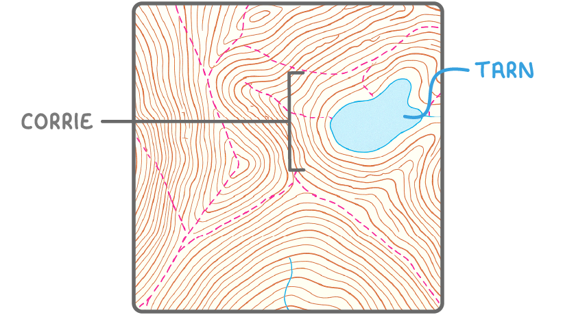
- Contour shape - Exhibit tightly packed contour lines arranged in a distinctive U-shape.
- Presence of tarns - Some corries contain tarns, which are small lakes.
Detecting glacial troughs and ribbon lakes
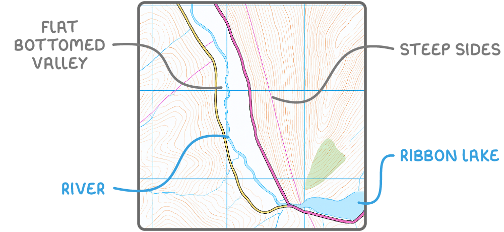
Glacial troughs and ribbon lakes are large-scale features resulting from the powerful erosive action of glaciers.
Features of glacial troughs
- Valley structure - Appear as broad, flat-bottomed valleys with extremely steep sides.
- Contour layout - Show no contour lines across the valley floor, but have densely packed contour lines along the steep sides.
- River mismatch - May contain rivers that appear too small to have carved such a large valley.
Features of ribbon lakes
- Location - Found within glacial troughs, nestled in the flat valley bottoms.
- Appearance - Present as long, narrow, and straight lakes on maps.
- Surrounding terrain - Enclosed by the steep sides of glacial troughs.
TermDefinition
Contour lineA line on a map joining points of equal height above sea level.
Pyramidal peakA sharply pointed mountain summit formed by glacial erosion.
ArêteA sharp, knife-edge mountain ridge formed by glaciers eroding on either side.
CorrieA hollowed-out, bowl-shaped depression carved into a mountainside by a glacier.
TarnA small mountain lake found inside a corrie.
Glacial troughA large, flat-bottomed valley with extremely steep sides, carved by a glacier.
Ribbon lakeA long, narrow and straight lake found in the bottom of a glacial trough.